|
|
Quick Scroll To:
DESCRIPTION
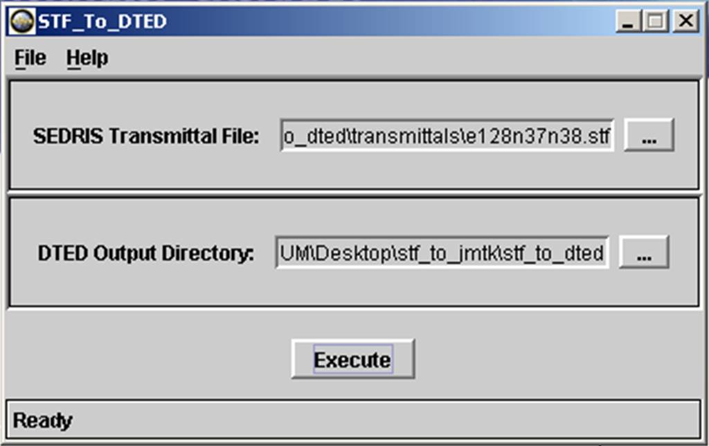
This free tool extracts gridded terrain elevation data from SEDRIS Transmittals (STFs) and creates National Geospatial-Intelligence Agency (NGA) Digital Terrain Elevation Data (DTED) files and directories.
NOTE: For a complete description of the DTED specification, please refer to MIL-PRF 89020B, which can be found at the NGA web site.
RELEASE INFORMATION
The current release version of this application is 4.1.1.1. This tool is compliant with the 4.1.1 release of SEDRIS technologies.
The application is linked statically, and additional documentation is
included in the download. You do not need to download or install the SEDRIS
SDK to use this tool.
FEATURES
STF to DTED Converter GUI
.

STF to DTED Converter Output Files
LIMITATIONS
SYSTEM REQUIREMENTS
Hardware
Software
POINT OF CONTACT
Send email to [email protected] for questions or assistance in using this application.
As a minimum, please provide the following in your email:
PLANNED IMPROVEMENTS
DOWNLOAD
|
|